French wildfire created a monster cloud, unleashing lightning that ignited more fires
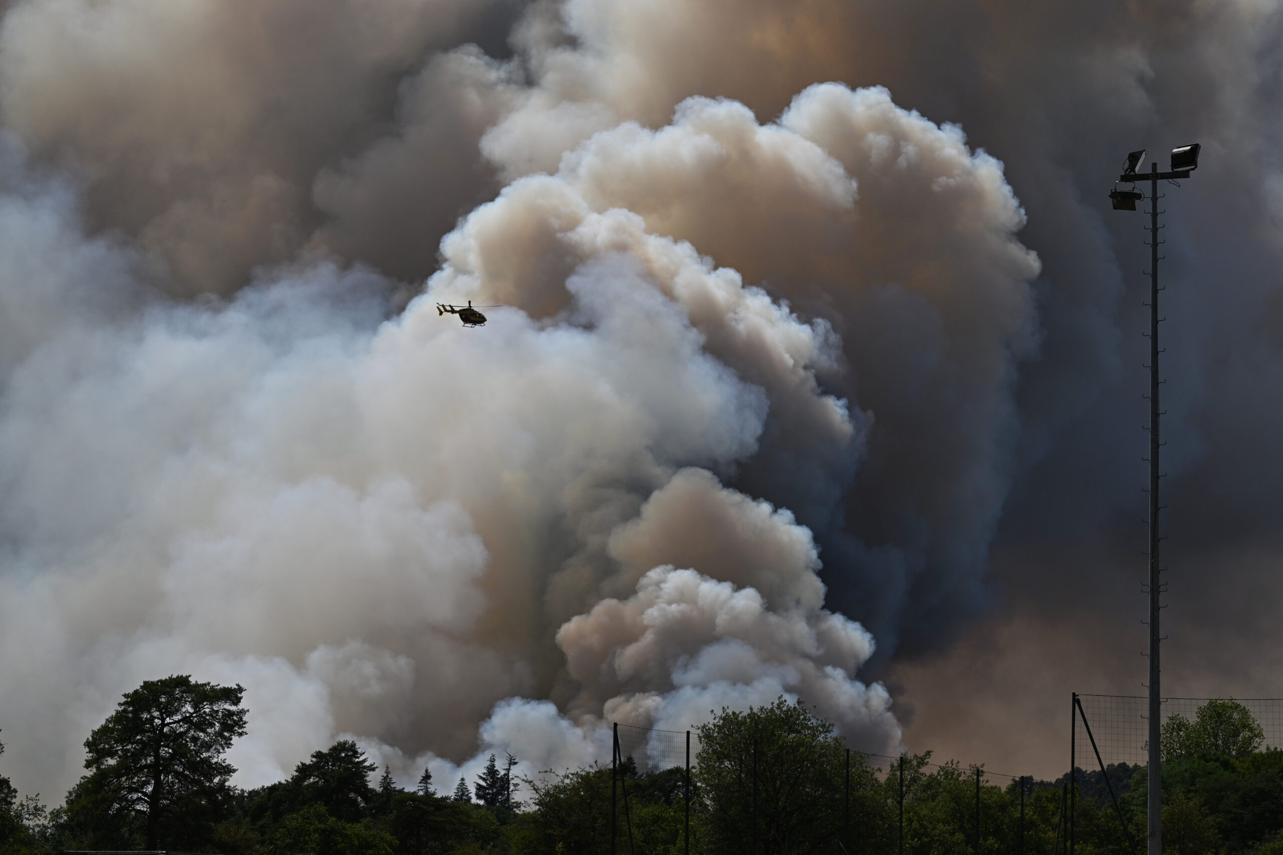
PARIS — A wildfire in southwest France grew so powerful that its smoke column became a thunderstorm, generating lightning that struck the ground and ignited new fires beyond the original blaze, French officials said.
Read more Voter ID-backers sue California attorney general over ballot description
Put another way, the inferno was making its own weather. The thundercloud also produced violent, erratic winds capable of driving the flames in new directions.
The phenomenon, called a pyrocumulonimbus, is rare in Europe and more common in North America and Australia, but only in the most extreme fires. France’s national firefighters federation said it never had recorded one in the country.
An electrified black thundercloud
“Imagine a campfire so large and hot that the smoke rising off it turns into a storm-like cloud,” said Theodore M. Giannaros, a fire meteorologist at the National Observatory of Athens.
“That is a pyroCb — a storm cloud born from the intense heat that a wildfire produces.”
It takes more than a big fire.
There is no set temperature at which one forms, Giannaros said; what is needed is the kind of atmosphere that breeds dry thunderstorms — very hot, very dry air near the ground, with cooler and moister air above it.
Hot air loaded with smoke and moisture then rises rapidly from the flames. As it climbs and cools, water vapor condenses around particles of ash.
Above the freezing level, droplets become ice crystals whose collisions separate electrical charges, as in an ordinary thunderstorm.
Lightning and more destruction follow
Beneath this storm lies a landscape primed to burn. The cloud then amplifies the disaster that created it.
Rising air pulls powerful winds toward the fire, while downdrafts punch gusts back to the surface.
Read more Trump meets with Ukraine, Israel leaders amid broadening conflicts
Those shifts can turn the flames, divide them into several fronts or send them racing in a new direction.
“It’s a feedback loop, not a one-way effect,” Giannaros said. “Once it forms, the cloud becomes its own weather system, sitting on top of the fire and making it harder to predict.”
The systems also can spin up whirling columns of flame — usually a fire whirl, which Giannaros describes as a dust devil made of fire and heat instead of dust.
True tornadoes are rarer, though one struck Redding, Calif., during the 2018 Carr fire with winds equivalent to an EF-3, killing a fire inspector.
For firefighters, escape routes can close without warning as fresh outbreaks appear beyond their crews and equipment.
Direct attack may become impossible, forcing crews to retreat and defend communities.
The danger, Giannaros said, is fire moving faster than evacuations can be organized.
The most common misunderstanding, he said, is that the cloud is merely a side effect. As long as it hangs above the flames, it is helping decide where the fire goes next.
Adamson writes for the Associated Press.